%20(1)%20(1).gif)
Know Where to Look First After the Earthquake
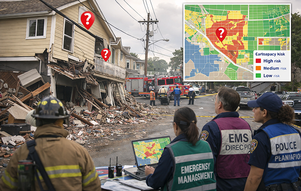
Identify where residential vulnerability may exist before the earthquake using data your city already has.
Our screening datasets help emergency managers prioritize post-event assessment and response planning using existing parcel data and publicly available imagery.
Why This Matters
After a major earthquake, emergency managers face an immediate operational challenge:
Where should responders be sent first?
Most jurisdictions maintain parcel data, but few have datasets that highlight where older residential construction patterns may require earlier inspection.
Mapping Seismic Data converts existing parcel data into planning-level screening datasets that support faster, more informed response decisions.
Request a Data Briefing
Mapping Seismic Data provides planning-level screening datasets for emergency management purposes. MSD does not perform structural engineering analysis, building safety certification, or regulatory enforcement.
Start with a Data Briefing
Most jurisdictions begin with a short introductory briefing to see how MSD screening datasets could apply to their community.