%20(1)%20(1).gif)
Services
Identify where residential vulnerability may exist before the earthquake.
Mapping Seismic Data provides screening services that help jurisdictions use parcel data, building age, and observable characteristics to identify patterns of potential vulnerability.
These datasets support emergency preparedness, response planning, and more informed decision-making when time and resources are limited.
All outputs are GIS-ready and designed to integrate with existing municipal systems
Built by an Emergency Manager for Emergency Managers
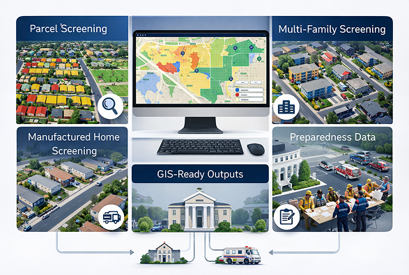
Screening Services

Primary Service
Residential Parcel Screening
This service reviews jurisdiction parcel data, focusing on residential properties constructed before 1980 — a period prior to significant seismic code updates.
The screening identifies visible building characteristics associated with increased earthquake vulnerability and organizes parcels into planning-level priority groups.
This supports emergency managers in making faster, more informed response decisions.
This screening does not replace engineering analysis but provides planning-level insight for emergency management purposes.
Additional Screening
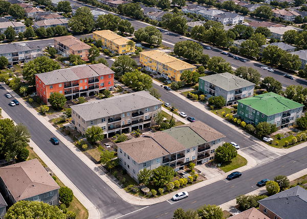
Multi-Family Residential Screening
For jurisdictions that maintain inspection lists for buildings containing four or more residential units, MSD can conduct additional screening focused on older multi-family housing stock.
This screening looks for building configurations historically associated with soft-story conditions that may experience increased vulnerability during strong ground shaking.
This helps identify potential soft-story conditions at scale.

Specialized Identification
Manufactured Housing Park Identification
Manufactured housing communities represent concentrated areas of residential vulnerability during disasters.
MSD identifies manufactured housing parks within a jurisdiction to support post-event assessment planning and resource allocation.
Strategic Support
Executive Leadership Briefing
MSD provides executive-level briefings to help leadership understand where vulnerability may exist and how to act on it.
These briefings explain the screening methodology, appropriate use of the data, and how the datasets can support preparedness planning and earthquake response decision-making.

From Data to Decision
Four-step, data-driven methodology delivering actionable insights in weeks — not years.
1
Collect
Public Data
MSD compiles publicly available parcel records, building information, and regional seismic indicators.
2
Apply Screening
Indicators
Data analysis identifies residential structures that may be more vulnerable based on building age, construction type, and other indicators.
3
Generate Vulnerability
Maps
The results are translated into GIS-based maps and datasets highlighting potential risk clusters across the jurisdiction.
4
Support Preparedness
and Response
Cities use these datasets to support earthquake preparedness, inspection planning, training exercises, and resilience initiatives.
Start with a Data Briefing
Most jurisdictions begin with a short introductory briefing to see how MSD screening datasets could apply to their community.